Trail number
Not applicable
Trail length
13 kilometres (can be longer if you head further into park area past Mount Sugarloaf).
Elevation variance
160 metres
Trail type
Single trail and management trail
Trail surface
Smooth dirt, coarse gravel, loose rocky surface, rocks and rock outcrops
Weather affected
All weather
Trail condition sources
Nil
Trail features
Nice chopped up fire trail, very steep climbs, great views, single track
Trail obstacles
Loose rocky surface with rock outcrops, fast loose downhill sections on management trails

Trail rating
Intermediate
Rating basis
Estimated
Night riding
No - gate across road half way up trail would not be able to be seen at night coming down mountain at speed.
Family Friendly
No - but good for a hike up to Sugarloaf or the mine with younger kids particularly in the wildflower season.


Article on mine discovery - refer middle section
The Antimony Mine and Sugarloaf Trails are located in the former Pyrete State Forest which has now been annexed onto the Lerderderg State Park. There are some good notes on the area incorporating this ride (including the Sugarloaf summit) provided by a bushwalker here.
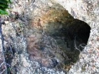
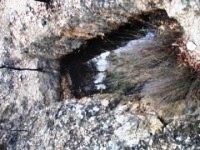
The Antimony Mine track is, not surprisingly, named after the Drapers Lode antimony mine which used to be in the area. The mine shafts, extensive crusher foundations and remnants of mining activity can still be seen. The crusher foundations are on the right of the trail as you head down near the other ruins. During the drought years, they were quite visible but are becoming slightly hidden now by the recent regrowth of the bush.
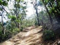
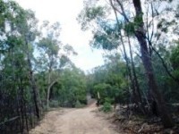
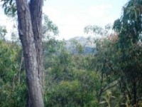
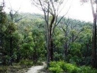
The Mount Sugarloaf track has a number of very steep rises and inclines along the way and is predominantly good quality management vehicle trails with a very loose rocky surface with a lot of dust in it. The trails aren't overly wide for vehicle trails and make for a pleasant ride with some great views of the area. A lot of the trail after Mount Sugarloaf is along ridge lines and you can ride all of the way north if you wished and pop out near Mount Bullengarook (refer notes further down page). Vistas through the tree tops of the surrounding area, particularly out to the west over the other part of the Lerderderg Park, are readily available.
The Antimony Mine Track down to the mine is a good ride as the track has not been used for some time and goes from a thin fire trail at the start down to single track for a large portion of the way.
The details in the notes below cover the ride up to Mount Sugarloaf area and the summit thereof and then the return trip taking in the Antimony Mine Track.
The main intersections are now well marked in the park which wasn't always the case.
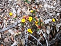
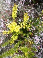
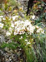
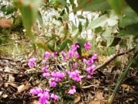
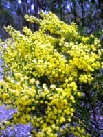
The wildflower season in this area starts around the start of October making some areas of the ride quite spectacular with native orchids, wattles, black boys, etc all putting on a display. Below are photos from October 2010 after the drought broke. Below are some pictures from a ride at this time of year.
 |
 |
 |
|---|
 |
 |
 |
|---|
 |
 |
 |
|---|
There are two gates across the trail coming down to the Antimony Mine Road car park which can appear quickly on downhill sections so be on the lookout for them. Trail surfaces are typically loose making quick stops hard on the downhills.
The trail surface is generally good but does have some sections with a fair amount of loose stones, gravel and dust. Some sections are very steep so take appropriate care to match your ability level. Experienced riders should have no issues however.
Beware of deep mine shafts in the Antimony Mine area.
Note that the park is closed on Code Red fire days.
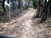
Finding the trail head is not so obvious. As you proceed down Antimony Mine Road, you get to a number of post box groupings which are set up to look like 'gates' and it looks like you are entering a private property. Keep going straight ahead through these as they're not private property and you will finally get to the trail head shown below in the first and second photos. The trail head is located at a turning circle at the end of the public access portion of Antimony Mine Road.
The following photo gallery has been taken from the Antimony Mine Road trail head. The photos follow the Antimony Mine Road to the mine area and then up to the summit of Mount Sugarloaf.
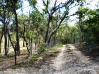
To get to the Antimony Mine and Sugarloaf area keep following the trail from the trail head and don't take tracks off to the right. Navigating is largely a non-issue now with the better signage in place. The road generally keeps rising steadily with minor downhill sections as shown in the photos below. You can follow this until you get to a downhill 'S' bend where the mine track is signposted. Alternatively, you can take the downhill short cut which is great fun. Refer map above and notes further down the page.
 |
 |
|
|---|---|---|
Sign located at entrance to park and parking area. |
||
 |
 |
 |
|---|
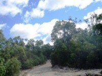
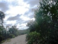
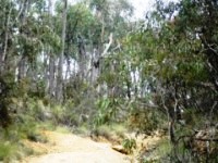
Trail starts with a steepish climb - nice views out to left over farmland. |
|---|
 |
 |
 |
|---|
 |
 |
|---|---|
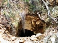
If you keep an eye out, you will see some small tracks off to right on way up and there are a couple of old mine shafts just off the road. |
|
 |
 |
 |
|---|
 |
 |
 |
|---|
 |
 |
 |
|---|---|---|
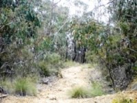
Yep - still climbing |
||
 |
 |
 |
|---|
 |
 |
 |
|---|---|---|
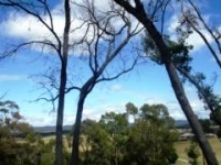
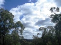
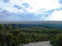
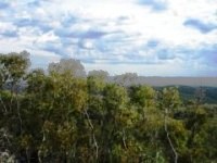
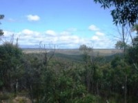
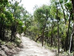
Some views from the trail. |
||
 |
 |
|
|---|---|---|
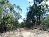
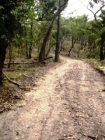
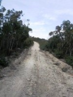
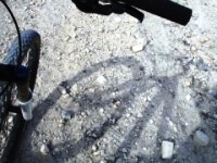
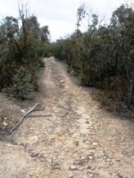
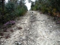
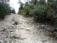
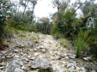
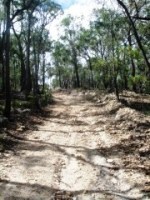
Some pictures of the trail surface for the management trails. Good for riding except where there are drifts of stones. |
||
 |
 |
|
|---|---|---|
Some pictures showing S bend before turn off and actual turnoff to Antimony Mine (now signposted). |
||
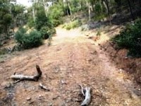
On the way in or out there is a short cut which cuts across from the main trail to the Antimony Mine Track which is worth the ride as well. It can be accessed from the main trail when you get to the flat portion of the trail before it descends. I have placed a large quartz arrow on the left hand side of the trail so you can pick it up. It's an extremely cut up trail which heads downhill to the Antimony Mine Track.
The flooding rains in late 2010 and early 2011 have made the bottom section pretty cut up which makes for a fun ride down. Give yourself a challenge and see if you can ride back up it. You'll probably have to hike a bike it for a bit but this section is pretty short. It makes for a good ride on the way down however. Note the photos below were taken prior to the heavy rains in 2010.
 |
 |
|---|---|
Turnoff to short cut track and starting to head downhill |
|
 |
 |
 |
|---|---|---|
Looking up downhill section - this looks completely different now with large erosion gullies and rock outcrops after the rains. |
||
Refer to the MTB Channel for further Victorian trail videos.
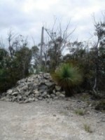
As you get up towards the Sugarloaf summit which you can see off to the right of the track, there is a side track that heads up to the summit. Refer photos below. The road is rocky but rideable. Note you are not at the summit until you get to the cairn shown in the last photo. The track is a bit deceptive half way up as it drops away again but keep going until you get to the actual summit.
 |
 |
 |
|---|
 |
 |
 |
|---|
 |
|---|
Refer to the MTB Channel for further Victorian trail videos.
The side trip down the Antimony Mine Track is a 5 km side trip and is well worth the effort to visit the mine and enjoy the trail. The trail starts out as a narrow vehicle trail but quickly deteriorates to a single track type of trail and is through a pleasant part of the forest. The trail is reasonably easy with a slight downhill on the way in and a gentle climb on the way out. Refer photos below.
 |
 |
 |
|---|
 |
 |
 |
|---|---|---|
Creek crossing at left followed by narrowing trail. |
||
|
 |
 |
|---|
 |
 |
 |
|---|---|---|
Bit hard to see in the first photo below but there is a nifty bridge made out of "reo" stitched together - quite novel and quite good to ride on as well believe it or not. Just be careful of a few bits of wire sticking up and a few holes (but nothing you'll plummet through). This is followed by single trail down to the mine area. |
||
 |
 |
 |
|---|---|---|
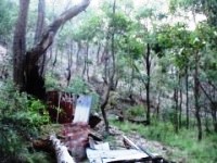
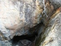
Ruins at base of antimony mine, pictures of mullock heap, shaft entrance and looking back down mullock heap. Be careful if climbing the mullock heap as the surface is loose gravel and is quite steep and slippery. Walk up the rain ruts for a better foothold or walk around edges. |
||
 |
 |
 |
|---|---|---|
Entrance to mine shaft and view from the mullock heap. |
||
 |
 |
 |
|---|---|---|
If you continue past the mine area, there are further mines and the old crusher foundation shown in the pictures above. |
||
From the mine area you can continue on down the trail. It appears to stop at the creek but this is not the case and there is an excellent little gorge / rock outcrop a bit further down the creek. I can't quite recall how it works but I think you drop down into the creek bed and head onto the track on the other side before again dropping back into the creek bed (which is dry 99 % of the time). This takes you down into the little gorge before again following the track along the creek. The track is described here as Track 19. Open it in Google Earth to see the trail. You can follow it for about a kilometre on bike. I tried the southern section of this track as well as it starts out on a fire trail but quickly deteriorates to a walking track (if you can call it that) though it did make for a good walk if you're interested.
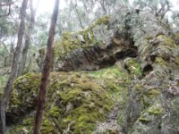
On the way out, there is a nifty rock outcrop in the forest up on the left called La Cathedrale d' Elisa - it's a grossly distorted bit of rock with some interesting surfaces for the photographers out there. See photos below.
 |
 |
|---|---|
La Cathedrale d' Elisa |
|
Refer to the MTB Channel for further Victorian trail videos.
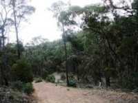
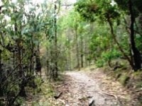
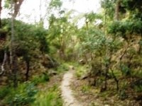
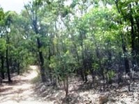
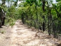
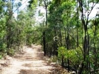
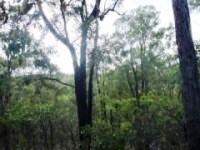
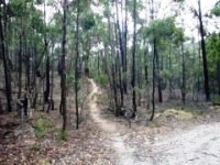
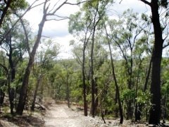
There is a trail located near the trail head just north of the gate and it heads off to the right of the main trail. It is unnamed on the map and heads north east before tracking east then south. It is also quite a nice ride and, as you can see in the photos below, the bush has a "closed in" feel around the track which makes for a pleasant environment to ride in.
 |
 |
 |
|---|
 |
 |
 |
|---|
 |
 |
|---|
 |
 |
 |
|---|---|---|
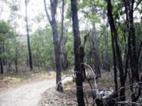
Steep rocky section |
||
 |
 |
 |
|---|
 |
 |
|---|
One thing I'm planning on doing is riding the park top to bottom as part of a day trip incorporating a train ride to Gisborne, picking up the northern trail off Whites Road, Bullengarook and heading through the park before heading down to Bacchus March and back to Melbourne by train to make a long one way ride.
To this end, in July 2012 I rode (well walked a fair bit) about a kilometre and a half into the park. The sign at the trailhead indicates it's about 10 km down to Sugarloaf Track which heads down to the southern gate (part of which is described above.
The maps of this area are quite unclear in that some show access through private land, some show trails that look relatively flat, etc. The reality was quite different. The person that built this road had a 4WD and obviously wanted to use it!
Below is the GPS plot of the short in and out trek I did following the management trail.:
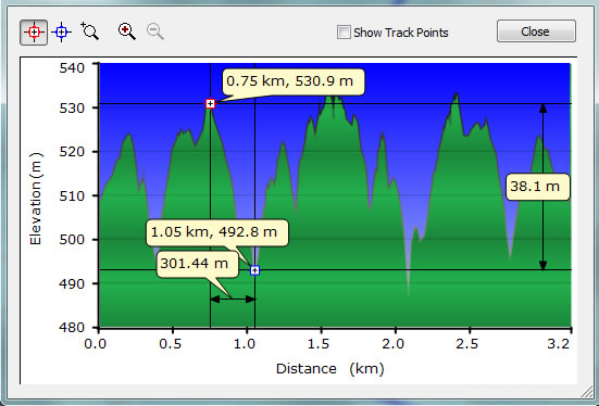
As you can see from the GPS plot, you travel 300 metres and drop 40 metres and are then faced with a steeper uphill. This was further made difficult by the clayey soil which limited grip and downhill speed. In summer, you could probably get some serious speed downhill and use it to roller coaster up the other side but this wasn't possible in the wet conditions with the limited grip. Hence, if you're going to try it, give yourself plenty of time and be prepared for a bit of hike a bike. While I haven't been there yet, I understand the mid section of the park is also very steep.
A short video of this section is below to give you an idea of what it was like. If you do this run through the middle of the park, drop me a report.
 |
Parking is available at end of Antimony Mine Road. |
|---|---|
 |
No toilet facilities are available. |
 |
No drinking water is available. Take plenty of water during hot weather as the wind does not circulate much in the valleys and the upper trails are very exposed. Add 5-10 degrees to the forecast temperature and this is what it feels like. |
 |
No food or drinks are available in the immediate area. |
 |
No local information facilities are available. |